


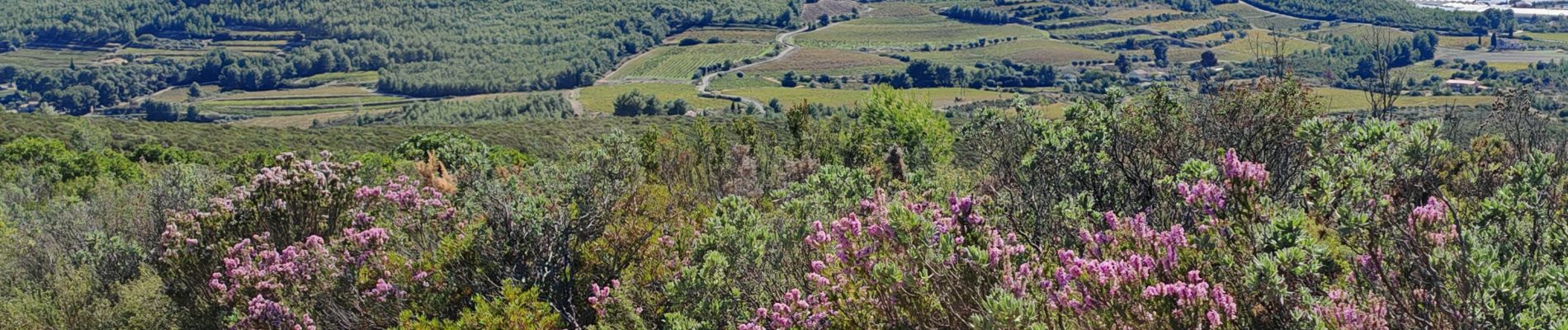
vers le fou de Ceyrestes

bernir
User
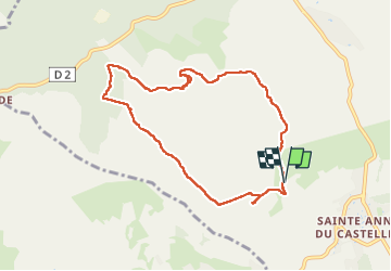

Length
8.9 km

Max alt
429 m

Uphill gradient
287 m
Km-Effort
12.7 km

Min alt
185 m

Downhill gradient
288 m
Boucle
Yes
Creation date :
2024-10-10 07:26:07.005
Updated on :
2024-10-11 08:05:09.791
2h53
Difficulty : Easy

FREE GPS app for hiking
 SityTrail
IGN / Geographical institutes
SityTrail Plus
The world is yours!
About
Trail Walking of 8.9 km to be discovered at Provence-Alpes-Côte d'Azur, Var, Le Castellet. This trail is proposed by bernir.
Photos


Positioning
Country:
France
Region :
Provence-Alpes-Côte d'Azur
Department/Province :
Var
Municipality :
Le Castellet
Location:
Unknown
Start:(Dec)
Start:(UTM)
723545 ; 4790195 (31T) N.
Comments